Geography

Geography

The Asir Region, which is shared by the mountain, the plain, and the coast, is located in the southwestern part of the Kingdom of Saudi Arabia, between latitudes 17.20 and 20.

The Asir Region, which is shared by the mountain, the plain, and the coast, is located in the southwestern part of the Kingdom of Saudi Arabia, between latitudes 17.20 and 20.50 north, and longitudes 41.30 and 44 east, extending over an area of approximately 80 thousand square kilometers, from Al-Darb, Al-Shaqiq, and Baysh in the Jizan region in the southwest to the borders of Yemen in the southeast and the Najran region in the east, and from the borders of Wadi Al-Dawasir in the Riyadh region to Raniyah in the Makkah Al-Mukarramah region, to Ghamid and Zahran in the Al-Baha region, to the coastal plain of

Al-Qunfudhah in the Makkah Al-Mukarramah region to the north and west, and part of the Red Sea coast, where more than 1,600,000 people live, spread out in 4,208 cities, villages, and regions distributed over more than seventy-eight governorates and centers belonging to the Asir Region emirate.

1Sections
6Images
6599Characters
عسيرCategory

Geography

The Asir Region, which is shared by

01

The Asir Region, which is shared by the mountain, the plain, and the coast, is located in the southwestern part of the Kingdom of Saudi Arabia, between latitudes 17.20 and 20.50 north, and longitudes 41.30 and 44 east, extending over an area of approximately 80 thousand square kilometers, from Al-Darb, Al-Shaqiq, and Baysh in the Jizan region in the southwest to the borders of Yemen in the southeast and the Najran region in the east, and from the borders of Wadi

Al-Dawasir in the Riyadh region

to Raniyah in the Makkah Al-Mukarramah region

02

to Raniyah in the Makkah Al-Mukarramah region, to Ghamid and Zahran in the Al-Baha region, to the coastal plain of Al-Qunfudhah in the Makkah Al-Mukarramah region to the north and west, and part of the Red Sea coast, where more than 1,600,000 people live, spread out in 4,208 cities, villages, and regions distributed over more than seventy-eight governorates and centers belonging to the Asir Region emirate.

The Asir Region is a region rich

03

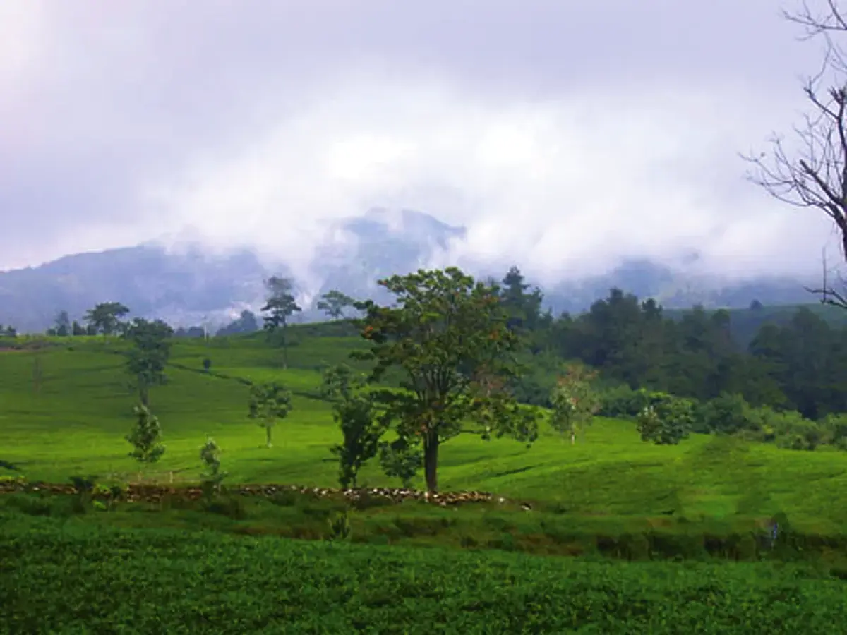
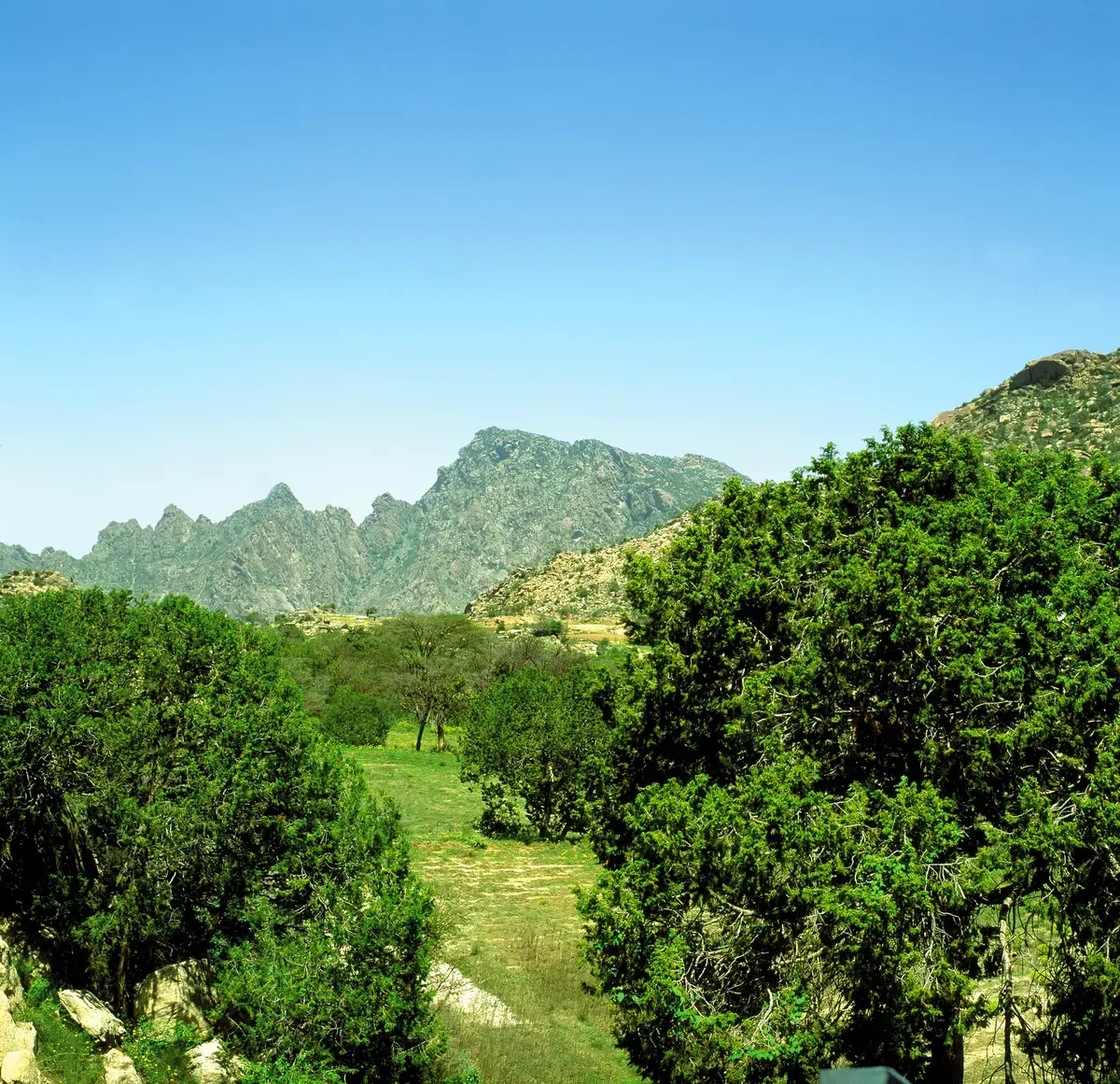
The Asir Region is a region rich in forests, green spaces, and agricultural plains, and this diversity of terrain makes the region one of the most beautiful regions in nature, and the most moderate in its climate throughout the year, not only in the Kingdom, but in the entire Gulf region, which makes it prepared for a distinctive tourist role that depends on the total elements of tourist attraction available in it.

The difference and variance in the Asir

04

The difference and variance in the Asir Region’s topography constitutes a topographic and climatic unit for all parts of the Arabian Peninsula. This is due to the fact that this topographic unit was formed in ancient geological times with the Great Rift Fraction that led to the separation of the continent of Asia from the continent of Africa and the emergence of the Red Sea.

This is a global phenomenon and its accompanying formations as a result of earthquakes and volcanoes.

This geographical unit with different topographies produced

05

This geographical unit with different topographies produced natural patterns that differ from each other completely, forming all the environmental patterns that make up the Arabian Peninsula.

We can divide these types into five geographical units

06

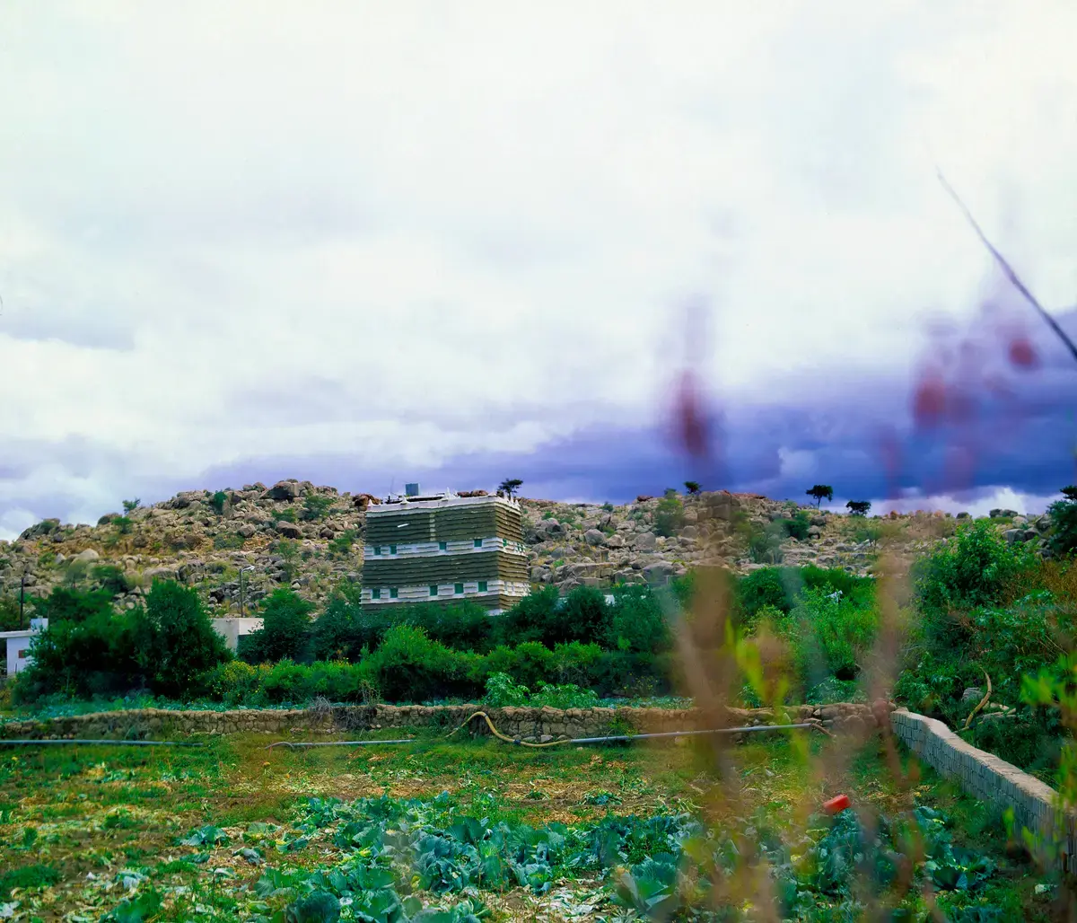
We can divide these types into five geographical units: mountains, eastern plains, the Asir coastal Tihama, the northern and southern Tihama, and the Asir Tihama, each of which has its own characteristics, which are: 1 - The highlands of the Sarawat Mountains: It is called Sarat Asir, and it is the heart of the Asir

Region, vibrant with movement and population density, as it is home to many urban and rural population settlement centers spread along the mountains from Dhahran Al Janub to the borders of the Al-Bahah region in the north.

It contains mountain peaks reaching a height

07

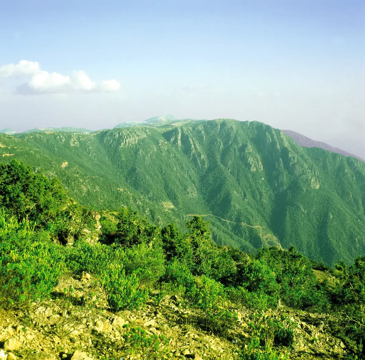
It contains mountain peaks reaching a height of two thousand meters, and the highest point on Mount Al-Sawda is 3,248 meters above sea level. The surface of these peaks slopes with sudden slopes towards the west and gentle slopes towards the east.

To form a flat plain, on its

08

To form a flat plain, on its surface are distributed the dormant Al Birkani peaks, the vast Al Birkani tuff, granite and metamorphic rock outcrops, in addition to eroded rock fragments from the mountains, and its height ranges between 600 and 1000 meters above sea level.

This region is famous for its dense

09

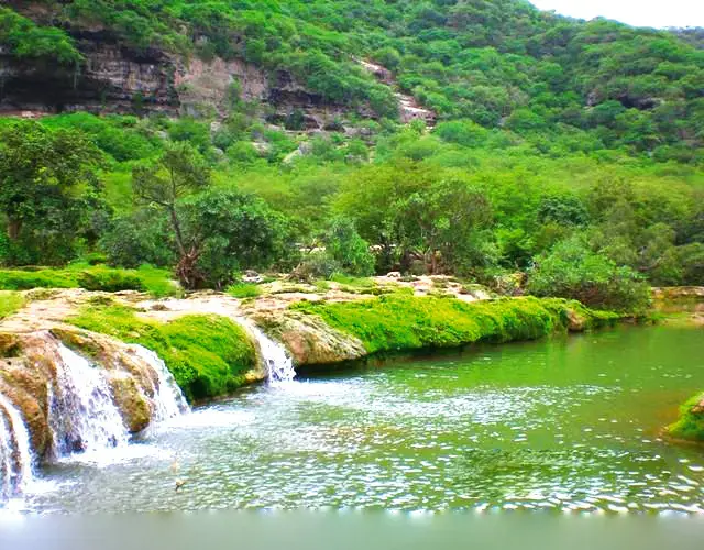
This region is famous for its dense forests of juniper, atam (wild olive), acacia, salam, samr, shath, tabaq, and other aromatic plants, and it abounds in valleys rich in water, waterfalls, and overlooking the Tihama to the west.

2 - The Eastern Plains

10

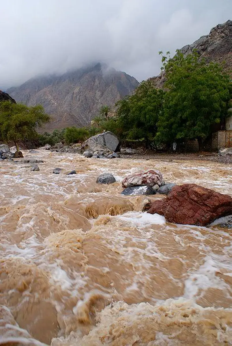
2 - The Eastern Plains: It is a semi-desert region characterized by the most famous valleys of the Kingdom, with fertility and richness in its oases, forests, and pastures, such as Wadi Abha, Wadi Atoud, Wadi Bishah, Wadi Tabalah, Wadi Taraj, Wadi Harjab, Wadi Khaybar, Wadi Bin Hashbal, Wadi Tathlith, and Wadi Bishah bin Salem.

These are seasonal valleys whose water flows

11

These are seasonal valleys whose water flows During the rainy seasons, some agricultural oases with abundant agricultural production of dates, fruits, grains, and all vegetables are spread across these plains.

3 - Tihama Asir Region

12

3 - Tihama Asir Region: It extends along the coastal strip of the Red Sea parallel to the mountains that form the coastal plain extending from the western slopes of the Sarawat Mountains with a width not exceeding 150 kilometers, and a height ranging between 100 and 150 meters above sea level. This plain is interspersed with canyons and valleys that carry rainwater from the tops of the western slopes of the Sarawat Mountains to the Red Sea.

It is characterized by a generally moderate

13

It is characterized by a generally moderate climate with a tendency to cold in the areas. Mountains and eastern plateaus.

These plains are characterized by a picturesque nature due to the fact that a number of large valleys pour their waters during the flowing seasons into these plains, and by their beautiful beaches that are warm in winter and by their multi-colored marine wildlife, which has not been affected by the negative effects of environmental pollution resulting from some industries.

The most important beaches are

14

The most important beaches are: Al-Harida Beach, Al Qahmah Beach, Dhahban Beach, then Al Birk, then Amq, Al-Sawalha Beach, and spread in front of its beaches in the open sea are some small islands that are considered a haven.

Naturally for many types of wildlife, including

15

Naturally for many types of wildlife, including fish, reptiles, and birds, the Asir coastal centers were important ports for exporting the Asir Region’s abundant products of wheat, barley, corn, lentils, sesame, millet, dates, some fruits, dried fish, ghee, honey, wool, leather, dum (bahash) fruits, and livestock of goats, sheep, cows, camels, and Arabian horses, whose breeding, trade, and export were thriving among some tribes in the Asir Region..

4 - Tihama Asir Region, northern and southern

16

4 - Tihama Asir Region, northern and southern: hot in summer and warm in winter, visited by the people of Sarat as a camp when the cold is severe, famous for its forests and valleys with perpetual waters and rich in its beautiful scenery. Among its most famous valleys are Wadi Dhila’, Atoud, Hali, Yaba, Reem, Khat, Haswa, Al-Ahsaba, and other great valleys around which cities, towns, and population centers are spread.

On agriculture and trade, ancient and modern

17

On agriculture and trade, ancient and modern, as these centers were important commercial links between Al-Sarrat and Tihama Al-Sahel. Their valleys and farms were fertile, and they still are, and they are famous for raising livestock of goats, sheep, camels, and cows, and agricultural production of corn, millet, and sesame, in addition to ghee and honey.

5 - Tihama Al-Asdar

18

5 - Tihama Al-Asdar: (the foothills of the western mountains from the western side) It is a region with moderate summers and warm winters, where forests, valleys, waterfalls, and beautiful, pristine views abound. It is famous for its coffee plantations, local bananas, and aromatic flowers.

The nature of the region has contributed

19

The nature of the region has contributed to the formation of its own history, which allowed it to play an important role in ancient land and sea trade routes, and it still maintains many features represented by existing monuments and urban formations that suit this nature and climatic conditions, including many castles and fortresses scattered among the mountains, which represent a necessary need for the inhabitants of the region in various eras.

Population clusters have also spread in locations

20

Population clusters have also spread in locations that provide their residents with natural protection and various life resources. As for the moderate climate of the Asir Region, it is due to its elevation in most parts of it above sea level, to the seasonal summer rains that fall on it, and to the diversity of its compositional fabric.

While the climate is moderate in the

21

While the climate is moderate in the highlands in the spring and summer, and tends to be cold in the fall and winter, the climate of the plain regions is dominated by moderation during the fall, winter, and spring seasons, then it becomes hot in the summer with high humidity in the coastal plains.

The summer monsoon rains that fall on

22

The summer monsoon rains that fall on the Asir Region contribute to the continuation of the green seasons there, and the expansion of the areas of forests and forest trees, as the rainfall rate in the Asir Region ranges between 200 and 500 mm annually.

The Asir Region is generally considered one

23

The Asir Region is generally considered one of the moderate rain areas, and the rain that falls on the western face of the Sarawat Mountains, which slope steeply towards the sea, forms coastal valleys that make these plains suitable for agriculture and provides water for the needs of its residents.

The moderate climate and low temperatures, especially

24

The moderate climate and low temperatures, especially in the mountainous areas, make them first-class tourist areas, as the temperature in the city of Abha, the capital of Asir, does not exceed 25 degrees Celsius in September, and drops to 18 degrees in October until it reaches only 8 degrees in the winter months, corresponding to a temperature ranging between 5-9 degrees in Al Namas, and ten degrees in

Bishah, which are degrees that indicate a cold climate in general.

Category: عسير